Fire danger mapping using deep learning
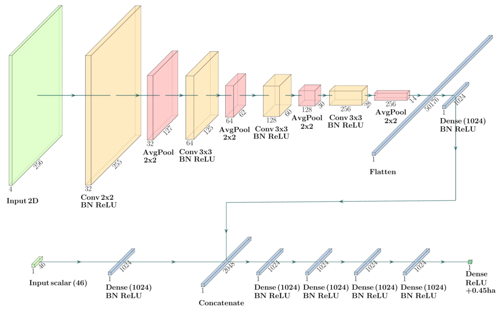
The evolution of a wildfire can be simulated using a numerical model that tracks the fire front and its propagation according to the available fuel, the meteorological conditions and the topography. One approach to assess fire danger over some territory is to multiply the probability of a fire ignition and the area that could be burned once a fire started. As soon as the territory becomes too large, this means running simulations at too many locations to be tractable. However, from a large database of simulations, it is possible to train a neural network to predict the area burned at every location with minimal time, instead of calling the propagation model.
The neural network is especially relevant as the inputs of the propagation model include fuel distribution (rich set of patches) and complex terrain (topography), plus scalar inputs for the meteorology. An illustration of the neural network configuration is shown below.
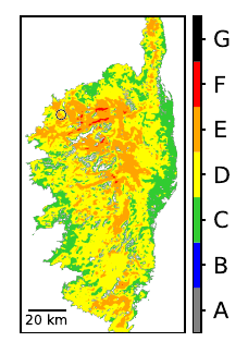
Trained on millions on simulations, the neural network is able reproduce the behavior of the propagation model. It can be used to generate danger maps like the one below, for Corsica.